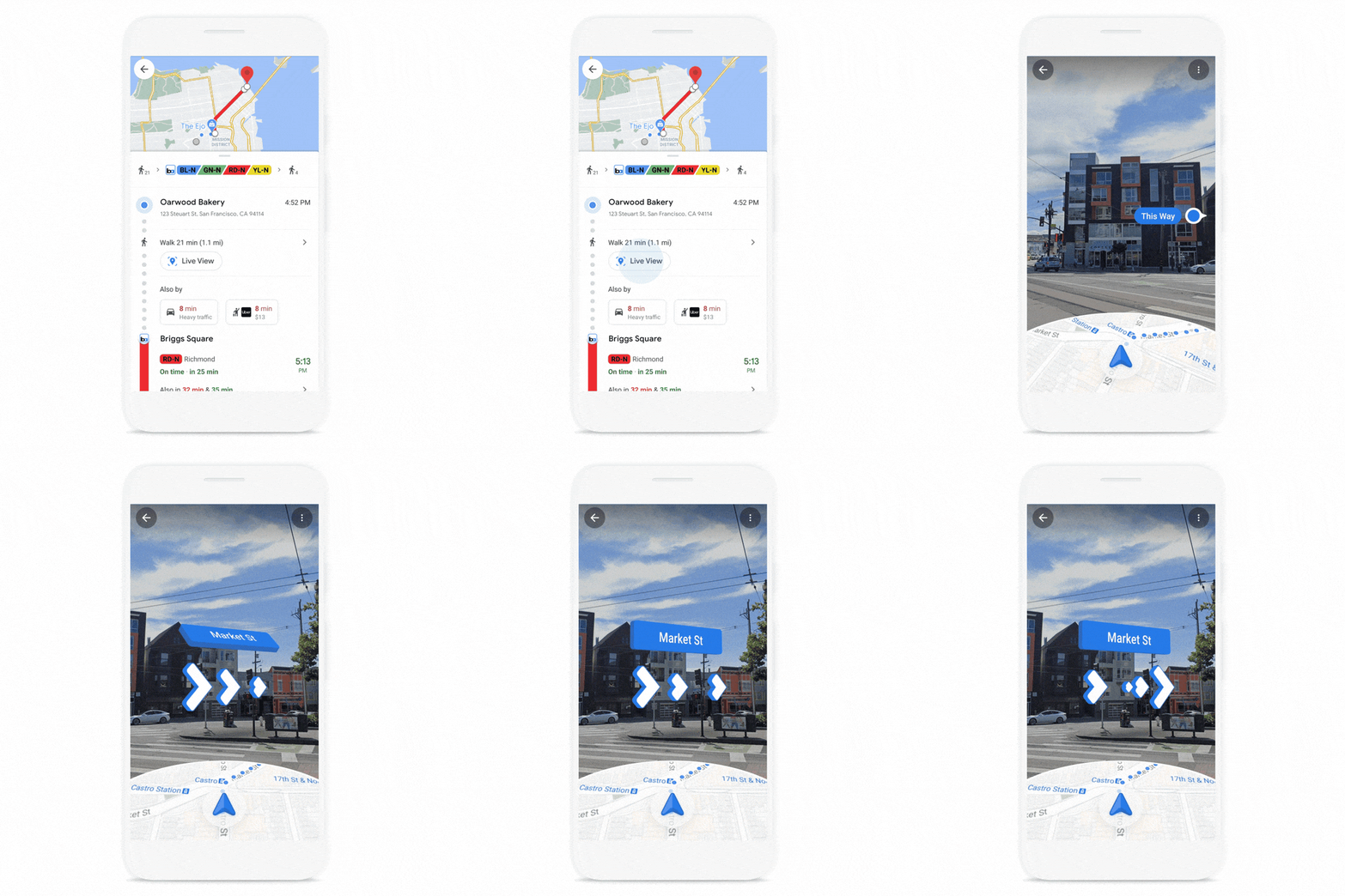
Google today announced a few updates to Live View, the augmented reality walking directions in its Google Maps app that officially launched last year. Live View uses your phone’s camera and GPS to tell you exactly where to go, making it a nice addition to the standard map-centric directions in similar applications.
The new features Google is introducing today include the ability to invoke Live View from the transit tab in Google Maps when you’re on a journey that includes multiple modes of transportation. Until now, the only way to see Live View was when you were asking for pure walking directions.

Image Credits: Google
If you’re like me and perpetually disoriented after you exit a subway station in a new city (remember 2019, when we could still travel?), this is a godsend. And I admit that I often forget Live View exists. Adding it to multimodel directions may just get me to try it out more often since it is now more clearly highlighted in the app.
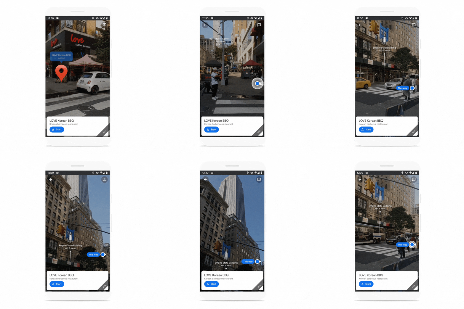
Google Maps can now also identify landmarks around you to give you better guidance and a clearer idea of where you are in a city. Think the Empire State Building in New York, for example.

Image Credits: Google
These new landmarks will be coming to Amsterdam, Bangkok, Barcelona, Berlin, Budapest, Dubai, Florence, Istanbul, Kuala Lumpur, Kyoto, London, Los Angeles, Madrid, Milan, Munich, New York, Osaka, Paris, Prague, Rome, San Francisco, Sydney, Tokyo and Vienna, with more to follow.
If you’re a regular Live View user, you’ll know that the actual pin locations in this mode can sometimes be off. In hilly areas, the pin can often be hovering high above your destination, for example. Now, Google promises to fix this by using a combination of machine learning and better topographical maps to place the pin exactly where it’s supposed to be.
Also new is the ability to use Live View in combination with Google Maps’ location sharing feature. So when a friend shares their location with you, you can now see exactly where they are in Live View, too, and get directions to meet them.

